The printed and smart digital maps are provided & free to use during your rentals. Each of our Polaris vehicles is equipped with a tablet and a custom Great Outdoors trail map showing your GPS location at all times.
These “smart maps” make it easy to explore the National Forest and community!
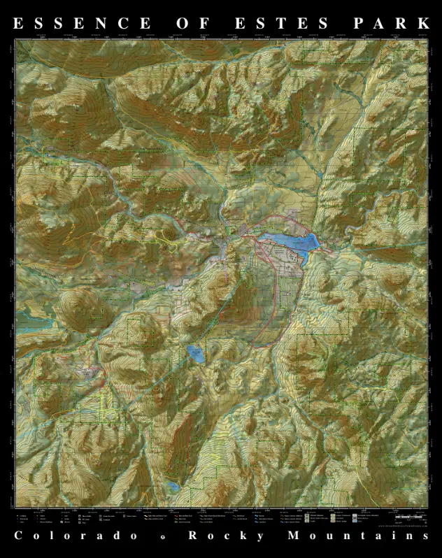
This beautiful Essence of Estes Park Map captures the essence of the Estes Park area and provides a wealth of information for visitors and residents. The map was designed as cartographic art.
Would you like to know exactly where you are on the map? A “smart” version of this map is available through the Avenza PDF Maps app. The app saves the map to your phone, so you always have access to it and your GPS location, even if you don’t have cell phone service. The app can also be used to record GPS tracks, points, and even plot points of where you took GPS-tagged photos. The Avenza Maps app is free but you’ll have to purchase the map itself. The app has an online map store built into it where you can find Great Outdoors Maps and many other maps you can download. This app will keep you on the right trails, having fun, and safely exploring public lands!
Time: 11 – 3 pm • Reservations Required • Self-Guided or Guided • Polaris UTVs & Jeeps
Join Great Outdoors Adventures (GOA) for a family fun Thanksgiving Turkey Trot Trail Ride this November. Take pictures with the GOA turkeys for an extra sweet time. We look forward to giving thanks with you!